Saturday, March 25, 2023

Star Party at Staunton River State Park


We arrived at Staunton River State Park Friday evening about 7am and setup our tent for the night. As soon as we finished setting up our camp we ate some dinner we had picked up from KFC.


We left for the field where the Star Party was to take place as soon as we finished eating. It was getting dark and clouds had moved in while we got our name badges. We stopped at the first booth and watched a slide show of photos taken with a telescope and listened as he explained what we were looking at. We moved down the end of the field to the last guy and the clouds were starting to break up. We used his scope to see the moon as it peeked in and out of the clouds. We started up the back row and as we talked to the first guy there, and he started showing us constellations, the clouds dissipated and the sky opened up. As the evening progressed, we viewed several scopes and was able to see different views of the moon, Venus and other celestial bodies. The last booth had the largest scope and we viewed galaxies. My favorite was the Orion Nebula! We see Orion's Belt here but it is actually a Nebula with many stars in it. We made our way back to the campsite after 9pm and made ready for bed.


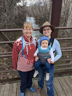
The next morning I was up early and made some coffee. I read for about an hour and had 3 cups of coffee and it started getting light. Oh yeah, Happy was not able to make this weekend, so his little brother came along. 


Before breakfast, I took down the tent and packed everything in the car. For breakfast, we had Peak Refuel Breakfast Skillet with Spinach wraps. 


The Peak Refuel Breakfast Skillet has enough in it for two people to have one serving each. It actually tasted good and it kept us full until lunch.


During breakfast we witnessed a beautiful sunrise and on the way home we stopped by Amy's grandparents home.


Friday, March 17, 2023

Hanging Rock State Park


The Drive to the Park

We left home about 8:30 AM and hit the road to Hanging Rock State Park. We were about halfway there when it started lightly raining. We drove through some beautiful country and arrived at the park about 9:45 AM. We entered the Visitor Center and talked to the gentleman sitting at the information counter, and he wanted to know what we wanted to do. I explained that the rock (main attraction) would be nice, but he explained the views today would be bad due to the weather. I mentioned we had already hiked that area and the Cascade Falls trails, the last two visits we made. He suggested we take the Cooks Wall Trail and visit Wolf Rock and House Rock. The distance is about the same and the views were great. We decided to take his advice and headed out to start our hike.

The Hike


We drove to the Picnic Shelter/Swimming Area Parking Lot and parked, there was no one else there. We put on our coats and slickers, it was cold, windy and raining. After following the lake, the trail turns up the mountain and it is uphill for about 1 mile. 


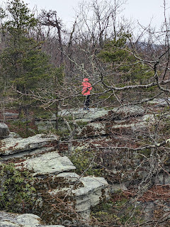
After we made the top of the hill, the trail split left and right. We went left to go and see Wolf Rock. Along the way we saw several unique rock formations and here is one of them. It looks like one flat rock stacked on top of another, and there was a small cave opening under the rocks.


We soon arrived at Wolf Rock and I ventured out on the rocks. The wind was really gusting and the rocks were wet, you had to be very careful. Mrs. C. would not venture out, she does not do well with heights and wind.


We left Wolf Rock and backtracked to the trailhead and this time we went right and followed the white diamond blazes (trust the blaze, more on that in a minute). It took us about 30 minutes to hike to House Rock, it was much bigger than Wolf Rock. I was able to get Mrs. C to venture out on these rocks though and we caught some great camera shots.


We decided to go ahead and finish out the trail by going to Cooks Wall, which added an extra 2 miles to the hike. The wind on the left side of the ridge was terrible and blowing fog around like it was smoke. Our right side was calm and had very little wind and clear, it was just amazing to see this first hand. There was not much to see at the end due to the heavy cloud cover, but had my picture taken there anyway.
 

We left and headed back the way we had come, and here is where the importance of trusting blazes come in. We came to a split in the trail and I followed the white diamonds like we should and I was convinced we were going the wrong way. We had gone about 1/4 mile down hill and I decided to go back and make sure we were going the right way. We headed back up the hill and once we were at the top, I discovered the blazes were right and I was wrong. Therefore, we went back down the hill for the second time and after going a little further than we had the first time, we were both confident we were on the right path. 


When we were near the end of the trail, we received a video call from our daughter and granddaughter. That was a special treat. 


Our Hike Statistics (thanks to G-Shock)


Notes

  • We meet 3 other hiking groups on our trek.
    • 1 runner that was getting it up and down the trail, we were jealous.
    • A group of young folks, about 8 of them, were standing at House Rock talking and taking pictures. 
    • Two gentlemen were starting up when we were coming down the mountain. They wanted to know how much farther, we told them it was a ways to go.
  • I forgot gloves, should have had them in my pack.
  • Pack sandwiches next time, do not depend on snacks.
  • Need to hurry and get my hiking shoes.

Follow us on Instagram, click the picture below.


Tuesday, February 21, 2023

Blackwater Creek Trail Review, Lynchburg VA

Trails of Blackwater Creek

Click Map to Download PDF


We were late getting to our destination, but we arrived around 2 PM. It was overcast, but there was no rain. We met up with my daughter and granddaughter at Hollins Mill Park, 521 Hollins Mill Road Lynchburg, VA 24503. There was parking, picnic tables, grills, and you can put in your canoe there as well. 


From this location at Hollins Mill Park, you can take your pick of several trails. You can access the Point of Honor Trail, Blackwater Creek Trail and the Kemper Station Trail (Information on each below).

From the Park we took the Blackwater Creek Trail from milepost 2 and walked to the end at milepost 3. This took us down the creek, through the Hollins Mill Tunnel and up to the train tracks and the skateboard park. 


We rested for a bit at the Point of Honor Bridge and then headed back the way we came.

 #Happy_The_Elf


By the time we were finished, we had walked approximately 3.5 miles in about 90 minutes. The pace was a little slower than normal but we were taking in the sites along the way.


Here are some observation from a novice's point of view and we will be visiting this trail again.

  • Paved surfaces were easy to walk on 
  • Wide enough for 4 people to walk side by side
  • You will find runners, walkers, bike riders and dogs with their owners on this trail system.
  • Several entrances to the trails
  • Parking may be scarce if weather is nice
  • There are trash bins on the trail
  • There are Porta-Potties on the trail
  • The signs made it easy to keep up with the trail you are on and the mileage.


The following is from the Trail Website.

Check out the trail safety and etiquette page for important information about staying safe on the trails, and how to have a good experience while traveling on the trails.

The Blackwater Creek Trail


The Blackwater Creek Trail is one of the most popular trails in the city. Following along the winding Blackwater Creek and built along an abandoned railway bed, this 3-mile paved trail is perfect for jogging, walking, or biking. It trail travels through a lovely urban forest, and is intersected at various points with earthen trails that allow visitors to delve deeper into the forested area and enjoy the many plants and wildlife species inhabiting it.

Trail Entrances: 

  • Ed Page – 1720 Langhorne Road
  • East Randolph Place – 340 East Randolph Place
  • Downtown Lynchburg –  Jefferson St. and 8th St.
  • Linkhorne Middle School – 2525 Linkhorne Drive (Limited hours.)

Point of Honor Trail


The Point of Honor trail section is a 1.5 mile spur off of the Blackwater Creek Trail, traveling past the historic Point of Honor home before connecting to the entrance of RiverWalk and back to the eastern end of the Blackwater Creek Trail. Point of Honor is a historic home, situated on a point of land in the Daniel’s Hill neighborhood overlooking the James River.  The trail also passes through scenic Hollins Mill Park.

Trail Entrance:

  • Downtown Lynchburg – Jefferson St. and 8th St.
  • Blackwater Creek Trail Mile 2

Kemper Station Trail


The Kemper Station Trail section joins the Blackwater Creek Trail near mile marker 2.0 and ends at the historic Kemper Street Train Station, connecting trail users to Lynchburg’s Midtown neighborhood and Miller Park. The Kemper Station trail section was dedicated on March 30, 2006.


Trail Entrances:

  • Kemper St. and Park Ave.
  • Blackwater Creek Trail Mile 2


Creekside Trail

Beginning at the Blackwater Creek Athletic Area, this earthen trail follows Blackwater Creek for approximately five miles. Located in a steep-sided stream valley, the Creekside Trail provides the perfect place to search for early spring woodland wildflowers, birding opportunities, and year-round wildlife observation. 

Trail Entrances:

  • Blackwater Creek Athletic Area
  • Point of Honor Trail

Ruskin Freer Loop


This 115 acre preserve is named in honor of Ruskin Freer, a noted teacher of biology at Lynchburg College who inspired generations of individuals to love and protect wildlife.  The preserve is located near the center of the Blackwater Creek Natural Area and shows various stages of plant growth marked by five interpretive signs and 36 plant identification signs along the loop trail.


Trail Entrance:

  • The Ruskin Freer Loop Trail can be accessed at different points along the Blackwater Creek Trail.